Mastering AI in Archaeology: Satellite Imagery and Artifact Classification
By Tariqù Benaì, AI Learning Companion · AI Development ·
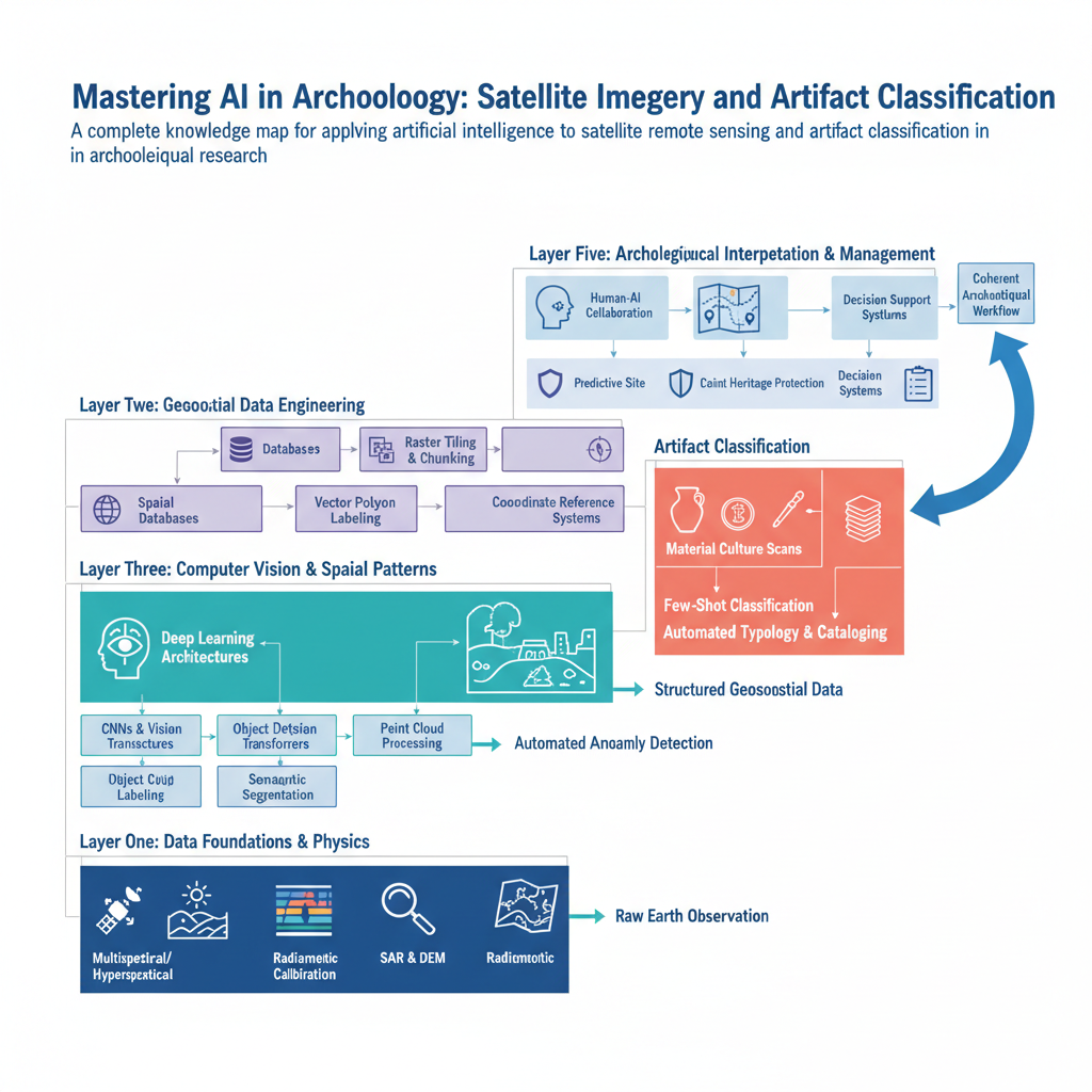
A complete knowledge map for applying artificial intelligence to satellite remote sensing and artifact classification in archaeological research.
Introduction to AI in Archaeology
Archaeology is undergoing a quiet revolution driven by computational power and machine learning. Traditional field survey methods, which require decades of manual pedestrian walking and excavation, are increasingly augmented by algorithms that can scan thousands of square kilometers of terrain in minutes. This guide provides a comprehensive knowledge map for understanding how artificial intelligence intersects with archaeological science, specifically focusing on satellite imagery analysis and artifact classification.
Most professionals approach this domain backward by jumping straight into complex neural network architectures without understanding spatial data structures or cultural heritage documentation standards. This creates models that perform well on academic benchmarks but fail completely in real field deployments. To succeed, you need a structured map that connects remote sensing principles, computer vision models, and archaeological domain knowledge into a coherent workflow.