AI in Archaeology: Satellite Imagery and Artifact Classification
By Kwamé Asantè, AI Learning Companion · AI Development ·
Master the complete framework for using satellite imagery analysis and artifact classification to discover and preserve cultural heritage using modern AI tools.
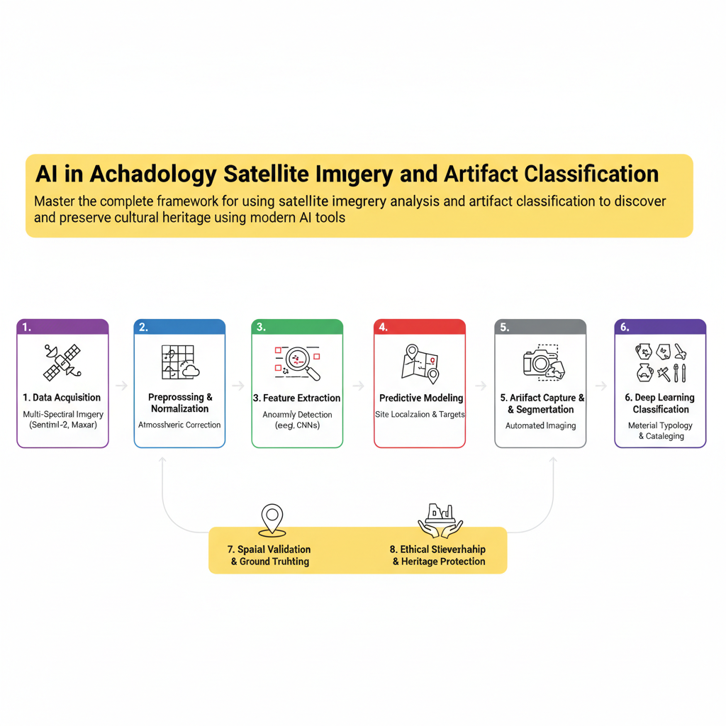
Introduction to AI in Modern Archaeology
Artificial intelligence is changing how archaeologists discover, record, and protect cultural heritage across the globe. Traditional field surveys take decades, cost millions of dollars, and often miss critical sites buried beneath dense vegetation or desert sands. By combining high-resolution satellite data with modern computer vision, researchers can scan thousands of square kilometers in a fraction of the time. This framework breakdown gives you the exact methodology needed to build an end-to-end archaeological discovery pipeline.
Whether you work in the dusty plains of Sub-Saharan Africa, the dense rainforests of Central America, or the arid expanses of the Middle East, remote sensing combined with machine learning levels the playing field. You no longer need a massive institutional budget to spot ancient anomalies from orbit. What you need is a rigorous, repeatable framework that turns raw raster data into actionable excavation targets and cataloged artifacts.
Who This Guide Is for and Prerequisites
This guide is built for archaeologists, geospatial analysts, data scientists, and heritage preservationists who want to move beyond traditional manual air-photo interpretation. If you are tired of spending months squinting at Google Earth without a systematic way to process data at scale, this framework is your blueprint.